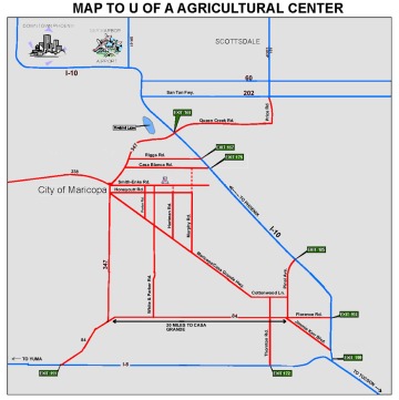
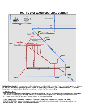
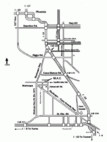
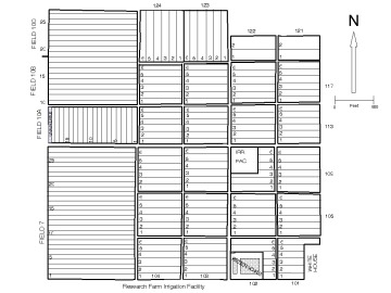
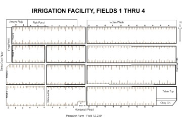
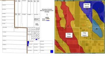
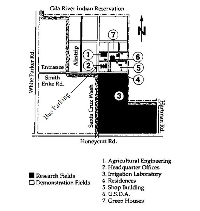
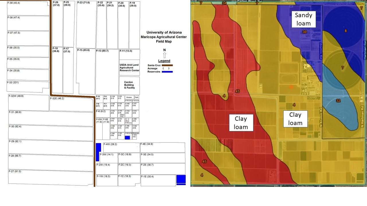
Select these maps to better acquaint you on how to locate MAC and see how the farm is laid out.
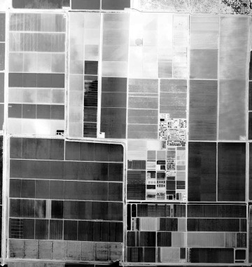
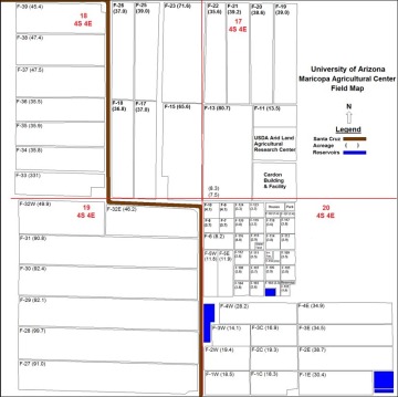

Irrigation Facility Field Maps
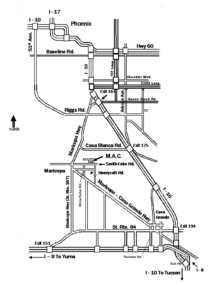
- Directions from Phoenix
- Travel South on I-10; exit at the Queen Creek exit #164. Turn right; you are now traveling South on Maricopa Road (SR 347). Proceed to the town of Maricopa (Approx. 16 miles) until you reach the traffic light at Smith-Enke Rd. (Walgreen's & CVS at that intersection). Turn left onto Smith-Enke Rd. Proceed 4 miles to the Administration Building.
- Directions from Tucson
- Travel North on I-10. Take Exit 199 (San Diego) Ramp West on I-8. Take Exit 172 onto Thornton Rd. Turn right (North) on Thornton Rd. Proceed 7 mi. to SR 238 (W. Cottonwood Lane/Maricopa-Casa Grande Hwy.) Turn left (West) onto SR 238 (Maricopa-Casa Grande Hwy.) and proceed 16 mi. Turn right onto White-Parker Rd. Go 4 mi. north to Smith-Enke Rd. Turn right onto Smith-Enke Rd. Proceed to the Administration Building (1 mile).
- Directions from Yuma
- Go east on I-8 and exit on Exit #151. Go to SR 347 (John Wayne Parkway/Maricopa Highway), turn left and travel 14 miles to town of Maricopa. Continue 1 mile to the traffic light at Smith-Enke Road. Turn right and head east 4 miles to the Administration Building.